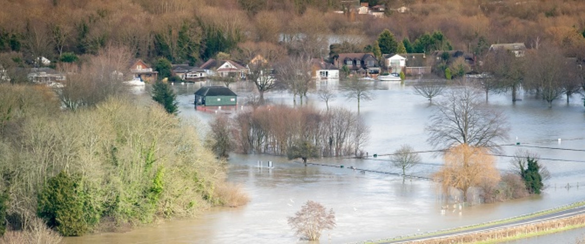
Suffolk 12 Catchments RoFSW Modelling
Surface water flood modelling for 12 catchments identified as potential flood hotspots within Suffolk County.
Surface water flood modelling for 12 catchments identified as potential flood hotspots within Suffolk County.
Suffolk County Council and the Environment Agency required an increase in both quality and coverage of surface water modelling and mapping. To achieve this the latest LiDAR data and the latest hydrology data and methods (ReFH2/WINFAP) as well as virtual pipes were used to create detailed 2D representations of the catchments including representation of the surface losses to the drainage system. 12 models were built which covered 19 townships across Suffolk, the largest being Ipswich. The modelling outputs of each study are being used by Suffolk County Council to inform localised planning documents which being used by the council to inform Strategic Development within the county.
The intention of the new mapping is to improve the quality of the RoFfSW maps, to raise public awareness of flood risk, improve understanding of surface water flooding, inform planning decision and ensure that sustainable development safely manages surface water flood risk. To do this detailed mapping of maximum flood depths, hazard and velocity are created. A composite worst case from all return period event durations was created which enables the Environment Agency to update their publicly available national mapping. In addition to this, analyse of the number of properties predicted to be impacted has been provided to the client across all return periods including climate change scenarios.
This information allows the council to complete outline business cases for flood intervention options, this will enable the council to calculate the costs of a scheme, calculate predicted flood damages, and complete partnership funding calculation to plan for future funding routes.
Hydraulic Modelling.
Hydrological Assessment
RoFSW Mapping Update
Property Counts
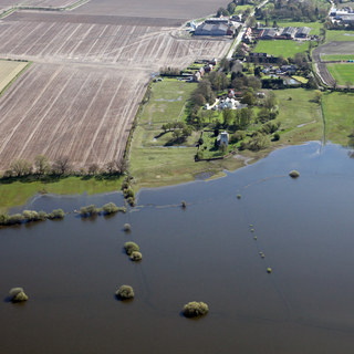
Surface water flood modelling for 5 catchments identified as potential flood hotspots within Suffolk County. Potential flood mitigation schemes along with a cost benefit analysis was presented for each catchment.
We developed a 3D hydrodynamic and water quality model of the region around the Abrolhos Islands in Western Australia. In collaboration with the University of Western Australia, model results were used to assess the impact of proposed finfish aquaculture on the surrounding environment.
We were contracted by TOTAL (Paris) to undertake cooling water discharge modelling studies on behalf of Shtokman Development AG.
The proposed expansion of the Port of Townsville involves significant dredging of sea bed materials to provide for vessel access, maneuvering and berthing.