College Park Landfill Pilot Study
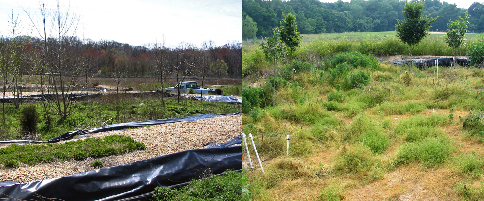
We conducted a Pilot Study of the College Park Landfill (CPLF), a 30-acre site operated as a municipal landfill from 1954 through 1978.
We conducted a Pilot Study of the College Park Landfill (CPLF), a 30-acre site operated as a municipal landfill from 1954 through 1978. Following closure, a cover was applied, but it was not closed in accordance with regulatory requirements. As landfills are known for their ability to mobilize hazardous substances into surrounding media, the CPLF was added to the U.S. Superfund (CERCLA) program for further evaluation.
We developed the Remedial Investigation Work Plan and Sampling Plan. Following investigations that included a soil gas survey, hydrogeological assessment, wetland delineation, and Site Screening Process risk assessment, we performed a pilot study to explore an alternative to the traditional landfill cover for closure. Alternative capping systems, such as evapotranspiration (ET) or vegetative caps have reduced costs, while meeting applicable regulatory requirements. In addition, carbon sequestration using vegetation and composted organic materials sequesters carbon from landfill gases, such as carbon dioxide and methane.
To address regulatory obligations, BMT investigated innovative alternatives to conventional closure methods. To combine the beneficial effects of both ET and carbon sequestration cover designs, BMT installed a pilot vegetative bioreactive landfill cap (VBLC) to evaluate these technologies which were approved by EPA Region III and state regulators.

BMT undertook a study to review the current regional industrial sectors and manufacturing facilities and propose future business targets, land use requirement and infrastructure design for the development of a new Integrated Port, Industrial and Logistics Estate.

Singapore's JTC Corporation, in collaboration with the Safety and Risk Management Safety Centre (SRMC) conducted a series of pilot Quantitative Risk Assessment studies to establish the applicability of the new QRA guidelines in the local context. BMT has been invited by JTC and SRMC to bid for the pilot study using new QRA guidelines on an existing manufacturing facility in Singapore.

We were commissioned to build a financial and business development plan for a Chinese Logistics Park.

BMT was commissioned to review and assess the master plan for a new logistics park in South Vietnam, including the logistics park facilities, industrial and manufacturing clusters, transport connections, land use planning and construction cost.