
14 February 2025
With the UK and beyond facing unprecedented consequences from rising water levels and climate amelioration, BMT are helping our clients in their need for flood alleviation, prediction, mapping and mitigation. Here’s 5 ways we can assist our clients:
Innovative Flood Risk Solutions: Crafting cost-effective strategies to mitigate local flood risks in urban areas.
UK regions and counties are attempting to balance the urgent need for economic growth and more housing paired with requirements to promote sustainable development and resilience for existing and new communities. As we seek to build and develop in a sustainable way, it is necessary to plan for the potential effects of a changing climate integrating blue-green infrastructure with the urban environment. We work with clients (chiefly Lead Local Flood Authorities) and stakeholders to mitigate flood risk from surface water accumulation and drainage infrastructure as well as flooding from rivers and sea, accounting for ongoing flood risk and planning for potential climate change effects, providing assessments of the economic, societal and environmental benefits and viability of strategies for adaptation and improvement.
Advanced Environmental Modelling: Conducting detailed flood and coastal risk modelling and mapping to support sustainable infrastructure planning.
As the owners and developers of TUFLOW, we use state of the art modelling software for river flooding and rainfall runoff flooding simulation, supporting strategic planning for more resilient and sustainable communities and environments. We incorporate qualitative aspects of river and catchment drainage dynamics with the TUFLOW CATCH and FV software. We use evolving spatial data analysis techniques to design and build modelling solutions for flood risk, and present to clients and stakeholders clear and accessible information concerning flood risk and benefit of proposed works.
With the advanced functionality available in TUFLOW, we aim to play a pivotal role in understanding and mitigating flood and coastal risks, enabling data-driven decisions for strategic and sustainable infrastructure planning. For those infrastructure and operations which interface with the coast, we aim to provide in-depth understanding of hydrodynamic, sedimentological and water quality understanding to help ensure sustainable operations whether it be through dredging, navigation or aquaculture.
Climate-Resilient Policies: Informing and adapting government policies to effectively address the impacts of climate change.
We work with key partners on strategies to ensure that key infrastructure and services remain resilient to a changing climate while maintaining sustainable objectives and attaining our Net Zero obligations. Our projects therefore incorporate climate change projections for peak rainfall and peak river flows in simulation of future flood risk as well as the projections for sea level risk affecting coastal areas.
People living or working in areas that are at risk of flooding can find themselves experiencing sometimes hazardous and life changing flood events. As knowledge of river and coastal systems becomes more comprehensive there is a need to ensure that flood alert and warning systems are providing the best available information to those in need of guidance for making decisions in difficult circumstances. The climate is changing, and with that comes an increase in the likelihood of flood events. Hydraulic modelling of coastal systems, rivers and overland rainfall runoff drainage can inform the development of thresholds allowing dynamic representation of hydrological systems to indicate the potential for, and severity of, flooding with sufficient notice to take action. Not all flooding is preventable, but advance warning of potential flood conditions allows action to apply preventative action or to be able to prepare sufficiently to minimise the impact to enable a faster recovery and minimise harm to communities.
BMT has expertise in dynamic river, drainage and coastal flood modelling which is used to identify the probability of flooding for specific locations at a range of intensities. This understanding of these flood risk receptors along with the sensitivity of their hydrological environment, allows the application of forecast severe weather along with upstream or antecedent indicators in gauged river catchments, rainfall gauge information and coastal buoys to forecast the potential for flood conditions at key locations with advance notice.
Effective Surface Water Management: Boosting catchment actions to manage surface water flood risk efficiently whilst improving water quality and biodiversity.
We enable a wide-ranging approach to surface water management, providing strategic assessment of flood risk to communities and planned developments and bespoke modelling of surface water pathways and drainage systems to support decision making at all scales, levels and stages of planning and development.
We take a collaborative, iterative approach with our clients to focus on key, achievable and sustainable solutions through detailed assessment of a range of options through hydrodynamic simulation and economic assessment to achieve the optimum solution to flood risk affected communities and infrastructure.
In heavily urbanised areas through to wide open rural areas, there are communities and land use activities affected by flooding that cause distress and economic damage. Understanding the dynamics of widely contrasting catchments enables us to focus on the key effects and contributing components of complex and diverse hydrological systems to find integrated and adaptive ways of managing land runoff as well as river flows to reduce flooding impacts at sensitive locations. In larger, complex systems we are able to use our understanding of the modelled environment to combine options for handling flood water to either slow it down or provide storage to reduce flood effects downstream.
Harnessing the power of modern technologies
Looking to the future, we foresee the latest emerging technologies in data acquisition and analytics and ever-increasing computer power having a profound impact on the way flood and coastal advisory services are provided. We are already developing partnerships that will take advantage of the ability to build whole city digital twins, to better integrate flood management into wider city planning. We can readily envisage that machine learning may be increasingly used to enhance the accuracy and speed of flood forecasting models by identifying patterns in historical data and will be looking for ways to incorporate this into our future service offerings.

James leads our Business Development and Future Business Strategy in the Water and Flood market. A frequently published author with credits in The Times, The Sun, NCE and BBC, James has spoken at events such as MIPIM and has addressed the Welsh Assembly Government and TfW on DEI issues. He continues to lead our client facing offering in the Resilience space.
Greg Fisk
The DCN spoke to our climate change risk, resilience and adaptation expert about preparing for the impacts of a changing climate.
Ian McRobbie
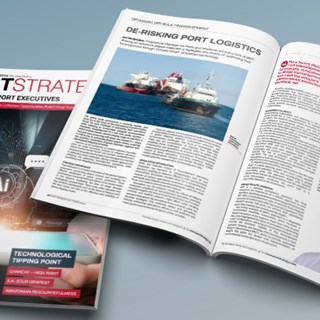
In a Port Strategy feature, Ian McRobbie highlights the merits of optimising bulk transshipment through ‘Climate-Smart’ simulation technology, drawing on extensive project experience

Jaret Fattori
Jaret Fattori's article in Port Strategy discusses how ports are adapting to climate change and IFRS S-2 regulations. Emphasising the shift towards sustainability through digital integration, decarbonisation, and innovative fuel alternatives, he explores the significant role of collaboration in advancing port sustainability and innovation.

Jaret Fattori
The regulatory landscape in Canada is evolving rapidly, reflecting a growing awareness of the need for more sustainable practices and responsible business conduct.